Do you love the idea of walking out your back door and casting off in minutes, but worry whether your boat will actually fit the dock? You are not alone. In Lighthouse Point, a great waterfront home starts with smart boat-to-dock matching. In this guide, you will learn how canal depth, beam, and draft work together, what affects inlet access time, and the exact checks to run before you make an offer. Let’s dive in.
Lighthouse Point canals: what to expect
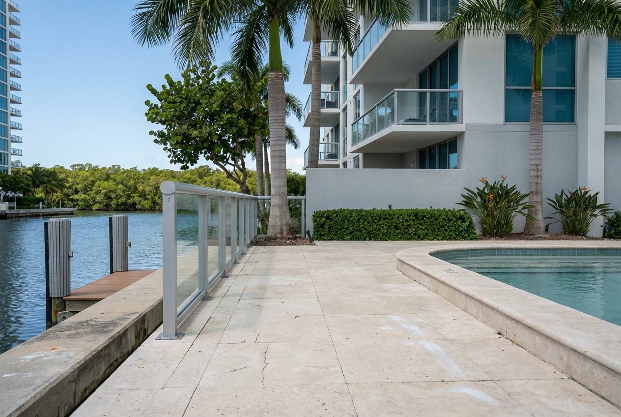
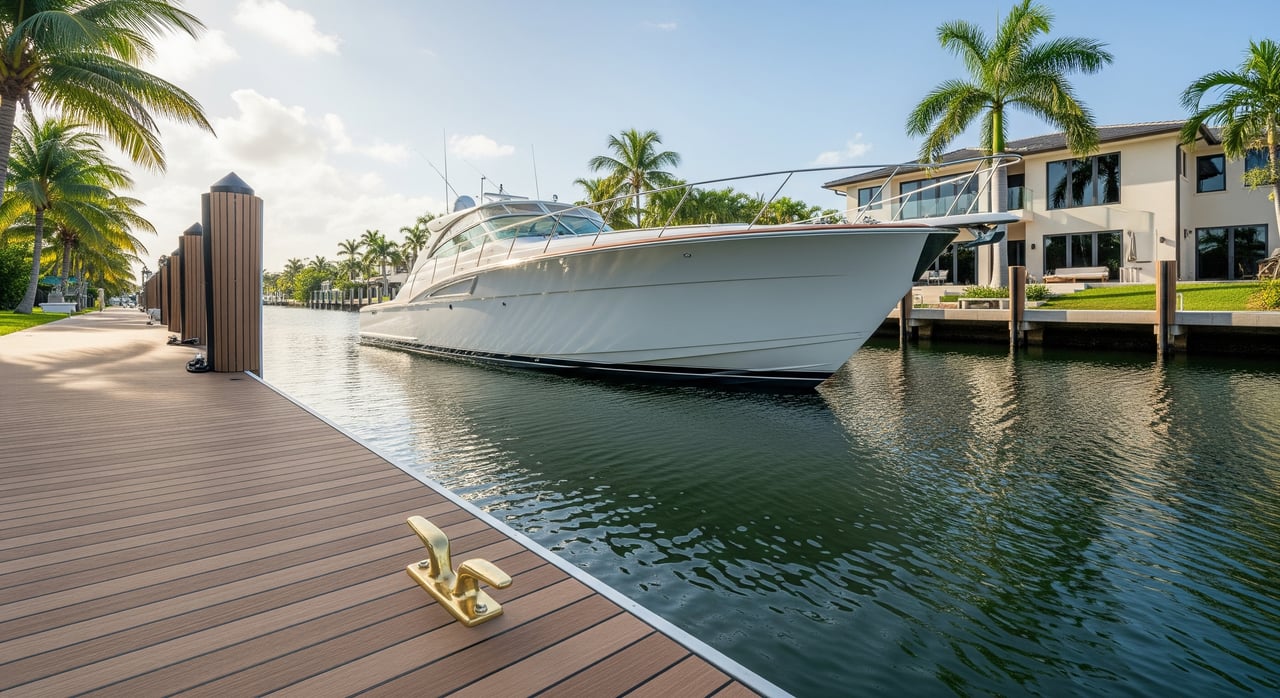
Lighthouse Point sits along the Intracoastal Waterway between Deerfield Beach and Fort Lauderdale. Many homes line man-made or modified canals that connect to the ICW and, from there, to the Atlantic through Hillsboro Inlet to the north or the Fort Lauderdale inlet area to the south. Listings often describe canal types differently, so it helps to know the common categories.
- Deepwater canal: wide, maintained, and often with direct ICW access. Suitable for larger boats and many yachts.
- Standard residential canal: single-family lots with private docks and finger piers. Often fits coastal powerboats and small to mid-size yachts, depending on depth and width.
- Narrow or secondary canal/cove: short spurs with limited turning room that may shoal. Best for smaller, shallow-draft boats.
- Community or HOA-controlled waterways: rules may limit boat size, lifts, or dock changes.
What makes a canal “deepwater” in practice is not just a label. Actual depth can differ from original design due to shoaling. Some canals are part of a maintained dredge program, while others rely on private owners. Seawall condition, pile spacing, and finger pier layout also affect how a boat sits and turns.
Depth, beam, and draft: the core numbers
Draft basics
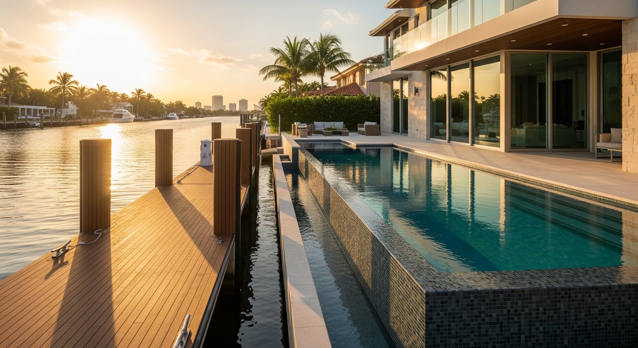
Draft is the distance from the waterline to the deepest part of your hull. Your draft must clear the canal and dock area at the lowest regular water level. South Florida tides are usually modest, often around 1 to 2 feet, but wind, seasonal changes, and shoaling can lower usable water. Sellers sometimes report depth at higher tide, so verify the number at a known datum like mean lower low water.
- Aim for a safety margin under the keel. For many recreational boats, target at least 1 to 2 feet of clearance at the lowest regular water level.
- Confirm depth at the dock and along your approach, not just in the center of the canal.
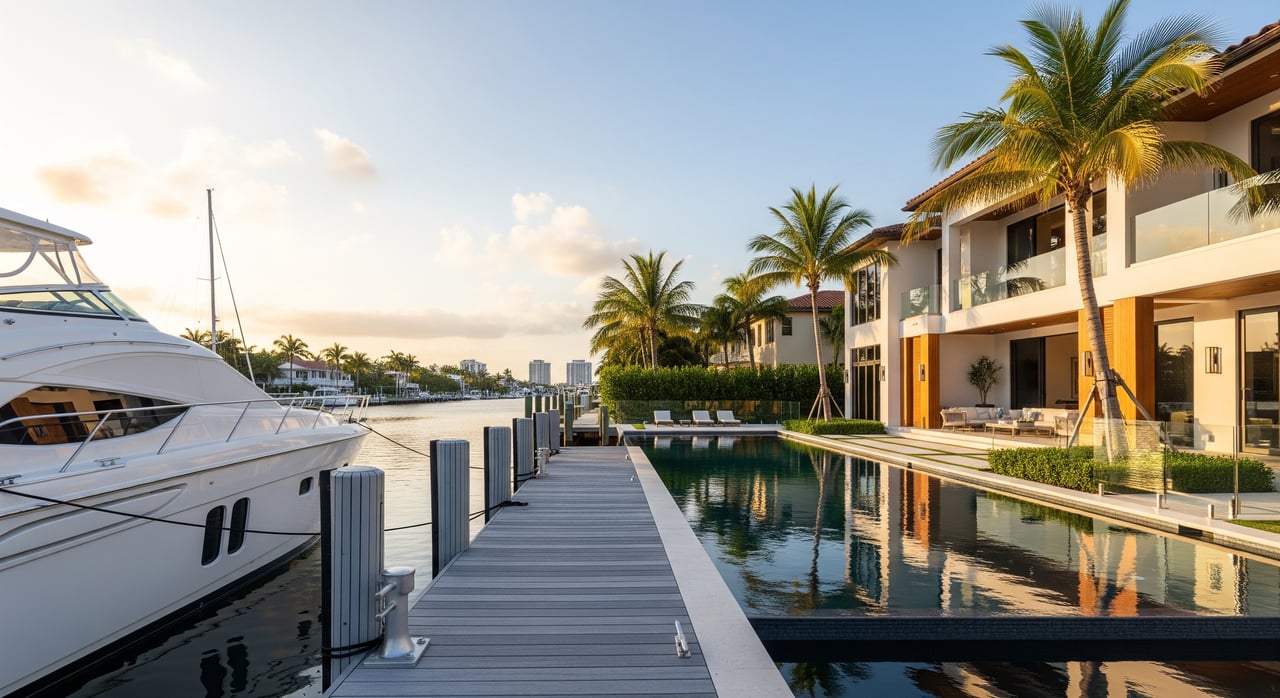
Beam and usable width
Beam is your boat’s widest point. It dictates slip width and how much room you need between pilings, docks, and neighboring boats. Many residential finger piers create slips between about 10 and 18 feet wide, while wider boats and multihulls often need 18 to 25 feet or more.
- Measure usable berth width between piles or dock faces.
- Subtract 1 to 2 feet total for fenders and clearance.
- Include any protrusions like outriggers, davits, or a bowsprit when you calculate.
Berth length and overhead clearance
Your berth length needs to exceed your boat’s length overall, including a swim platform and any bow extensions. Pile spacing and walkway access determine how you can tie off and how much of the dock length is usable. If your boat has a tall profile, confirm vertical clearance for nearby fixed bridges or overhead lines on the route to the ICW or inlet.
Quick fit test you can run
Gather three property measurements: minimum measured depth at the dock at low water, usable berth width, and usable berth length. Compare them to your draft, beam, and full LOA. Add margin: about 1 to 2 feet of depth clearance, 1 to 2 feet total in width for fenders, and a few extra feet in length for lines and ease. If the canal requires idle or no-wake passage, allow extra maneuvering room, especially for longer boats.
Inlet access and realistic run times
Nearby inlets and routes
From Lighthouse Point, most boaters use Hillsboro Inlet to the north or the Port Everglades/Fort Lauderdale inlet area to the south. Your choice depends on where your dock sits, conditions, and your plans for the day. You will reach the inlet via marked ICW channels and posted slow or no-wake zones.
Estimate your time with simple math
A simple planning formula is: time in hours equals distance in nautical miles divided by speed in knots. Convert hours to minutes by multiplying by 60. Use realistic speeds based on waterway rules.
- In canals and parts of the ICW, expect slow or no-wake speeds, often about 5 to 10 knots.
- Offshore, many powerboats cruise between about 20 and 30 knots, and many cruisers run 18 to 25 knots for comfort and fuel economy.
Many Lighthouse Point docks are a short ICW hop from Hillsboro Inlet. At cruising speed, some transits to the inlet approach could be on the order of 10 to 15 minutes from certain docks. At slow ICW speeds, the same trip could take 20 to 40 minutes. Always measure the actual channel distance for your route, and allow extra time for slow zones, traffic, and any bridge openings.
Permits, dredging, and maintenance over time
Depths change. Shoaling and seasonal sand movement can reduce depth in secondary canals and near inlets. Some areas benefit from periodic maintenance dredging, while others rely on private action from owners or HOAs. In Florida, dredging typically requires permits from the Florida Department of Environmental Protection, and in many cases the U.S. Army Corps of Engineers. Broward County and the City of Lighthouse Point also oversee local rules for docks, seawalls, and lifts.
Responsibility for dredging or seawall repair varies. It can be private, shared through an HOA, or tied to municipal programs. Confirm who pays, whether any assessments are planned, and if past dredging records exist. Storms may also shift channels or deposit debris, so check recent conditions before you commit your boat to a slip.
Your property shortlist checklist
Use this quick checklist to qualify a property before you invest time in showings or inspections.
- Request dock depth in writing, with the tidal stage or datum noted. Ask for documentation or recent soundings.
- Confirm who is responsible for dredging and seawall repair. Ask about past dredging and any planned assessments.
- Measure usable berth length and width. Note pile spacing, materials, and finger pier layout.
- Check for fixed or opening bridges, overhead lines, or any height limits on the route.
- Clarify if the waterway is public, private, or HOA-controlled. Review any boat size or lift rules.
- Verify local access to shore power, fuel, and pump-out if needed.
On-site verifications add confidence:
- Hire a surveyor or local captain to run a depth sounding at low water.
- Walk the seawall to look for erosion and inspect tie points and piles.
- If possible, approach the dock by boat to test turning room and current.
- Cross-check bridge clearances at mean high water if you have a tall mast or hardtop.
- Review plat, title, and HOA documents for easements and restrictions.
Common deal-breakers many buyers use: less than about 1 foot of under-keel clearance at low tide for typical powerboats, berth width narrower than your beam plus fenders, or tight canal geometry that prevents safe turning for your boat’s length.
Who to call for reliable information
Before you finalize a purchase decision that depends on dockage, consult these sources:
- NOAA nautical charts and tide predictions for depth contours, markers, and tidal timing.
- U.S. Army Corps of Engineers for navigation and dredging permits.
- Florida Department of Environmental Protection for dredge and fill rules.
- Broward County and the City of Lighthouse Point for dock, seawall, and lift regulations and permits.
- U.S. Coast Guard Local Notice to Mariners for bridge openings and navigation advisories.
- Local surveyors, tow operators, or marina captains for on-the-water conditions and realistic inlet run times.
Ready to match your boat to the right Lighthouse Point home? As a waterfront-focused advisor in Broward’s coastal corridor, I help you verify depth, beam, draft, and access before you write an offer. Connect with Linda DiFabio to plan your search and see the best-fitting options on the water.
FAQs
What does “deepwater canal” mean in Lighthouse Point?
- It generally refers to a wider, maintained canal with direct ICW access that suits larger boats, but you should still verify measured depth at low water, usable berth size, and turning room.
How much under-keel clearance should I allow for my boat?
- For many small to midsize recreational boats, target about 1 to 2 feet of clearance at the lowest regular water level; larger vessels should consult a marine professional.
How long does it take to reach the ocean from a Lighthouse Point dock?
- It depends on your exact location, speed, slow zones, and bridges. Many docks are a short ICW hop to an inlet, with total times often under 30 minutes, but measure channel distance and plan for delays.
Who pays for canal dredging and seawall maintenance?
- Responsibility varies by canal and ownership. It may be a private owner, an HOA, or a municipal or county program. Confirm in property and local records before you buy.